GeoParquet
The open standard for features and their attributes: compact, quick to query, opened directly by DuckDB, QGIS, Python, BigQuery and more.
Drop a Shapefile, GeoPackage or GeoTIFF. Geobox stores it as GeoParquet or Cloud-Optimized GeoTIFF and gives you one link that DuckDB, QGIS and Python read in place. Ask your AI assistant about it in plain words. No server, no download.

Why cloud-native
Classic GIS files have to be downloaded whole, or put behind a map server someone must run. Cloud-native formats are organised so that each tool reads only the part it needs, straight from where the file is stored. Faster, cheaper, and nothing to maintain. Geobox makes them for you, with the right settings.
The open standard for features and their attributes: compact, quick to query, opened directly by DuckDB, QGIS, Python, BigQuery and more.
Satellite images, elevation and other rasters, read tile by tile at any zoom. The format of the big open archives, such as Sentinel-2.
Already have cloud-native files online? Link them: Geobox reads them where they are, without copying them.
How it works
Shapefile, GeoPackage, File geodatabase, GeoJSON, CSV, KML, GeoTIFF, JPEG 2000… or a link to a file, a map service (WFS, ArcGIS) or a STAC catalog. Geobox stores each one as GeoParquet or Cloud-Optimized GeoTIFF, sorted and compressed for reading online, and keeps your original.
Files that are already cloud-native stay where they are: link them, Geobox reads them in place. Ready-made open data is there too, in our catalogs: OpenStreetMap, the world's administrative boundaries, US Census boundaries and numbers (ACS), FEMA flood zones and National Risk Index, protected areas (PAD-US), US addresses and place names, Natural Earth, Geoconnex water features, MassGIS, Corine land cover. Add them to your box as links, or query them where they are.

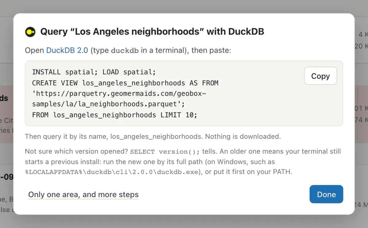
Each dataset has its address. Paste it in DuckDB and query it in three lines, add it to QGIS, read it from Python: only the parts a query needs travel, never the whole file.
Private datasets stay private: the address goes through your workspace's own key. Or download any of them as GeoPackage, Shapefile, GeoJSON, CSV, KML or FlatGeobuf.
Imported from a web address? Geobox checks it daily, weekly or monthly, on the day you pick, and updates your copy when the source changes.
Type a colleague's email to share a dataset: it appears in their own box, always in its latest version. Someone outside Geobox? Send them a copy in the format they need (GeoPackage, Shapefile, CSV…), by email or with a link. Or publish datasets in an open catalog that QGIS and STAC tools read directly.
Connect Claude, Cursor or any assistant that speaks MCP to your workspace, with a key made on the AI page. Ask in plain words: it lists your datasets, learns what each column holds and queries them in Geobox, alone or joined with the open catalogs.
Geobox tells it what it can't guess: what each column contains, what your files' own metadata says, and the notes you write for it on each dataset. With a key that acts, it also adds files, makes new datasets (a buffer, a clip, the buildings in a flood zone) and sends a copy by email.
Every dataset opens on a map in your browser, millions of features included, and maps of several layers can be public: each layer says where its data comes from and under which licence. Styles, classes and the rest are in Help.

Acknowledgements
Geobox stands on open source work by people and communities who share it freely. Thank you to:
Free to start
Every feature, 10 GB for your files, files up to 5 GB, no card. Sign in with your email: we'll send you a code, no password to remember.
Need more room, several workspaces or a team? See the plans.
Private preview
Geobox is being tried by a small group while we make it better. Tell us a little about you and the data you work with, and we'll get back to you.
We use these details only to answer you, and delete them whenever you ask.
Your request is in. We'll write to you at soon.